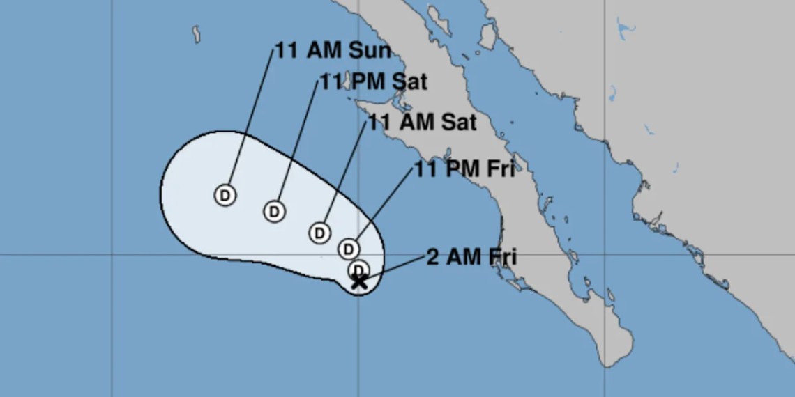
Post-Tropical Cyclone Lorena is expected to bring heavy rainfall to parts of the Southwestern United States, according to the National Hurricane Center (NHC). The storm system could deliver 1 to 2 inches of rain across the region, with isolated areas in Arizona and New Mexico potentially receiving up to 4 inches, raising the risk of scattered flash flooding.
On Wednesday, Lorena was a Category 1 hurricane with wind speeds of approximately 75 mph off the coast of Mexico’s Baja California peninsula. The storm weakened and was downgraded to a tropical storm by Thursday morning. The NHC issued its final bulletin on Friday, reclassifying the system as a post-tropical cyclone, meaning it no longer has the characteristics of a tropical storm.
As of 5 a.m. ET Friday, Lorena was located about 170 miles west of Cabo San Lazaro, Mexico, with maximum sustained winds of 35 mph. The storm was nearly stationary but is forecast to move north-northwestward by early Saturday before turning west-northwest over the weekend. Forecasters anticipate Lorena will continue to weaken, becoming a remnant low by Friday night and dissipating completely by Sunday evening.
There are currently no tropical watches or warnings in effect. However, officials advise communities in Baja California and northwestern Mexico to monitor updates, as ocean swells generated by the storm may continue to affect parts of the coast.
Lorena is the 12th named storm of the 2025 Eastern Pacific hurricane season.
Source link


