SAGINAW, Mich. (WNEM) – After temperatures turned a little bit warmer over the weekend, we’re cooling back down again for several days. This is leading to some re-freezing on some roads, in addition to some snowy conditions too as a few snow showers have been moving through. The full list of school closings and delays can be found by clicking here!
After the cold weather these next few days, temperatures warm back up briefly at the end of this week, before another drop-off again. Take a peek in your full TV5 First Alert 7-Day Forecast.
Today
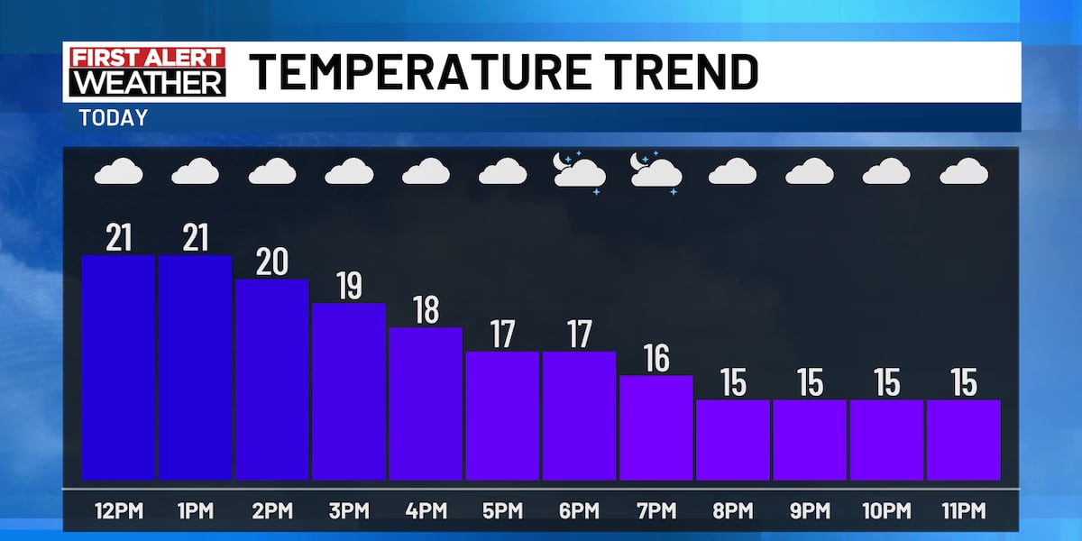
While we haven’t had any major delays on our roads this morning, you’ll certainly still need to account for some extra time for your drive as roads are slick. This extra time will range anywhere from 5 to 15 minutes, depending on how long your commute is. Temperatures have fell below freezing and will actually continue to fall through the day.

With those falling temperatures during the day, we’ll eventually have upper teens by dinnertime or the evening commute, around 5 to 6 PM. With the stout west wind at 15 to 20 mph, gusting to 30 mph, wind chills will be in the single digits. The “high” for today at sunrise will be around 25 degrees. The normal high for January 13th is 30 degrees.


In regard to snow showers, this morning’s activity has been widespread for our southern counties, but will scale-back as the rest of the morning carries on. After that, for mid-Michigan as a whole just the occasional flurry will move through. Skies will stay mostly cloudy in between any snow showers.

Tonight
An occasional flurry is also possible tonight, but the bigger story is the cold weather. Lows will fall to around 8 degrees with a west wind at 10 to 15 mph, gusting to 25 mph. This means we’ll have sub-zero wind chills on Tuesday morning, be sure to bundle up! Some clouds could clear overnight too, which will allow temperatures to sink quickly, especially when factoring in the fresh snow cover.
Tuesday
The wind will shift to the northwest as a weak disturbance moves through. This will allow snow shower coverage to pick back up in a scattered fashion, possibly seeing something similar to Monday morning. Areas who see more persistent snow showers could possibly see up to an inch of snow, but most see at least a dusting. These snow showers will pick up more in the afternoon and evening, so the morning will be relatively quiet.

Highs reach 22 degrees with that northwest wind sustained at 10 to 15 mph, gusting to 25 mph. This will cause wind chills to hold on to the lower teens and upper single digits again. Lows on Tuesday night fall to 13 degrees.

Ice Update
The slightly warmer weather over the weekend didn’t impact ice too much at all. Actually as of this morning, coverage is still higher than Friday, especially for the Great Lakes as a whole. That percentage is now up to 9.4% in this morning’s update, the same day last year we were at 2.36%. Not bad!

We’re continuing to urge caution on the Saginaw Bay specifically as there are still some open water areas and thin spots. You’ll still need to spud for thickness and be vigilant of wet or slushy areas on the ice. You’ll still want to think of the current ice as having early-season conditions. Be safe, and good luck if you’re heading out fishing!

Copyright 2025 WNEM. All rights reserved.


