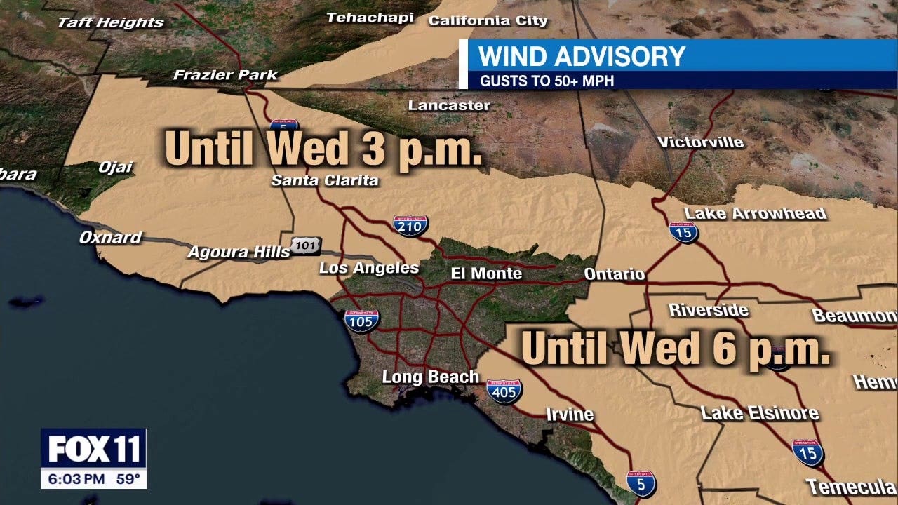
Dangerous winds, Red Flag Warnings continue
With Santa Ana winds developing slowly and weaker than originally anticipated, the National Weather Service has delayed implementation of “particularly dangerous situation” red flag warnings — which were supposed to begin early Tuesday morning — until 3 a.m. Wednesday.
LOS ANGELES – Officials warn the peak of the Santa Ana winds – along with the ensuing wildfire concerns – have been pushed back by about a day from the original timeline.
The updated timeline comes as the strongest winds were initially expected to hit between Tuesday morning and through Wednesday at noon. Now, the National Weather Service warns the winds will be weaker on January 14, but will pick up during the overnight hours.
The new projections hint that the winds will between 3 a.m. to 3 p.m. on Wednesday, January 15.
This week, the Santa Ana winds are expected to hit the region, possibly sparking more fires in Los Angeles, Orange, Riverside, San Bernardino and/or Ventura counties. The National Weather Service declared a rare PDS, or “particularly dangerous situation,” red flag warning for the Los Angeles area ahead of this week.
Below is a timeline of what to expect and when winds will peak:
WEDNESDAY, JANUARY 15
- The peak is expected between 3 a.m. to 3 p.m.
- Peak gusts for LA County mountains may reach 70 mph. Southern California coasts and the San Fernando Valley may see gusts peak between 30 and 50 mph. The winds may end up being weaker than initially feared earlier in the week, but NWS warns winds will be strong.
A “particularly dangerous situation” warning, or PDS, is rare and reserved for the most extreme events, though this is the fourth time it’s been issued this fire season.
THURSDAY, JANUARY 16
- Red flag warning is expected to expire at the end of the day.
What is a red flag warning?
Similar to the fire weather watch, the red flag warning kicks in when meteorologists and forecasters believe conditions could lead to extreme fire within 24 hours.
PREVIOUS COVERAGE: Fire weather watch vs. red flag warning: What is the difference?


:max_bytes(150000):strip_icc()/010725-joe-alwyn-taylor-swift-news-social-300e899baa7948a2a232f31880b1beb4.jpg)

