HOUSTON – Your weather team is watching for the chance of patchy dense fog this morning followed by a risk for severe weather this afternoon into the evening.
DOWNLOAD TODAY: Storm Tracker 2 weather app from KPRC: Because Mother Nature doesn’t send invitations
Just like Christmas Eve afternoon, the Stormtracker 2 weather team will be tracking some strong to severe storms through the afternoon and early evening hours today. This morning, we’re already seeing some storms firing up out in west Texas as a strong low pressure center plows across Texas today.
You can track radar where you live here:
Timing on Today’s Storms:
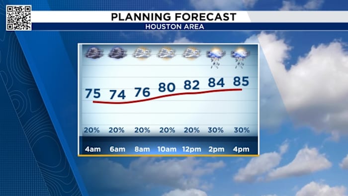
If you have to get out and about today, the morning hours will be better with just some scattered showers but turning much stormier as the day goes on.
There is a lot of spin to the atmosphere today with the center of the low pressure storm digging into Texas.
Along with a stronger jet stream, any storm that can pop, can have some spin to it and we may see an isolated tornado warning or two. Otherwise, storms will bring heavy downpours, lightning and even some hail.
Thankfully, this should be a fast moving system so by this evening, most of the storms will have moved east into Louisiana. We’ll stay mostly dry on Friday before another system will bring in some rain but nothing severe for Saturday.
10-day Forecast:
We’ll continue to track temperatures in the 70s, finally starting to dry out by the end of the weekend. We’re looking good for NYE plans Tuesday night and then after a wet NYD, we’ll start 2025 in the 60s with lows in the 40s.
Copyright 2024 by KPRC Click2Houston – All rights reserved.


